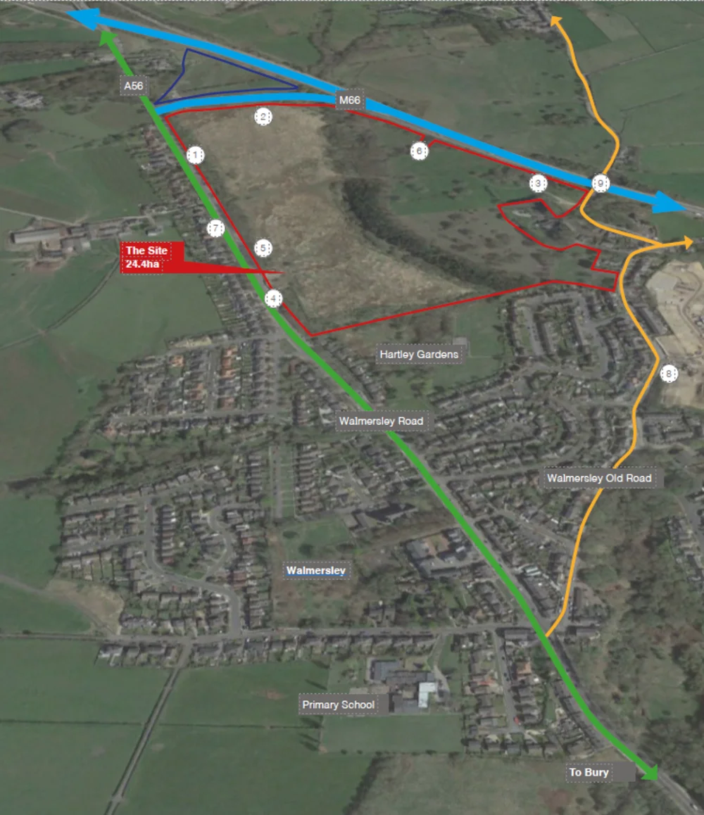
Hollins Strategic Land (HSL) will shortly be submitting a planning application proposing the residential-led development of accessible and sustainably located land at Walmersley Brook, Bury to provide some 350 new homes, a neighbourhood centre, a business/employment area, publicly accessible green spaces and a park and ride facility.
This public consultation is seeking the views and support of local residents, businesses and other stakeholders to help inform the planning application as it evolves in close liaison with Bury Council and all other consultees. Your views are important and HSL would welcome your participation in this exercise. Please note that the consultation closes at 5pm on Sunday 14th September 2025.
The site has previously been considered to be a potentially suitable development site by Bury Council and the Council has suffered from a shortage of deliverable housing land and small business employment space for a number of years.
Large scale housing allocations in other areas of the Borough will require significant upfront infrastructure before being in a position to deliver housing, employment and other development. The Walmersley Brook site does not require any significant upfront infrastructure provision and can therefore deliver housing, employment and other development in early course.
This is a logical site for new development, sustainably located, physically well- contained and partly previously developed. As a Grey Belt site, the proposed development is appropriate in the Green Belt and will help to meet the Government’s aim to significantly boost the supply of new housing.
HSL’s vision is to create an organic extension to north east Bury that is integrated into the existing built fabric in terms of design and layout, including pedestrian and cycle connectivity to local services.
The development will provide a mix of housing, commercial, employment, retail and community facilities to support the growth and enhance the sustainability of north east Bury:
Share your feedback on these proposals by using the survey section at the bottom of this page.
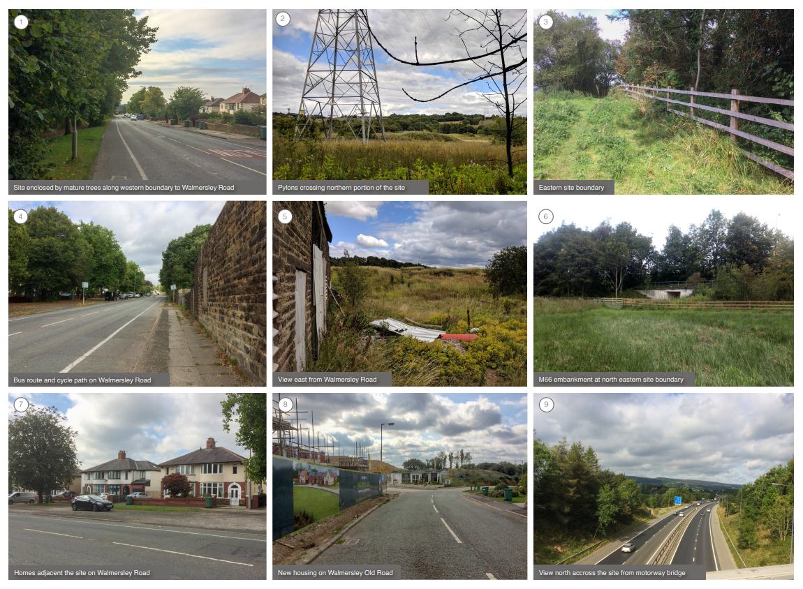
The existing site conditions can be summarised as follows:
The site offers a range of opportunities to:
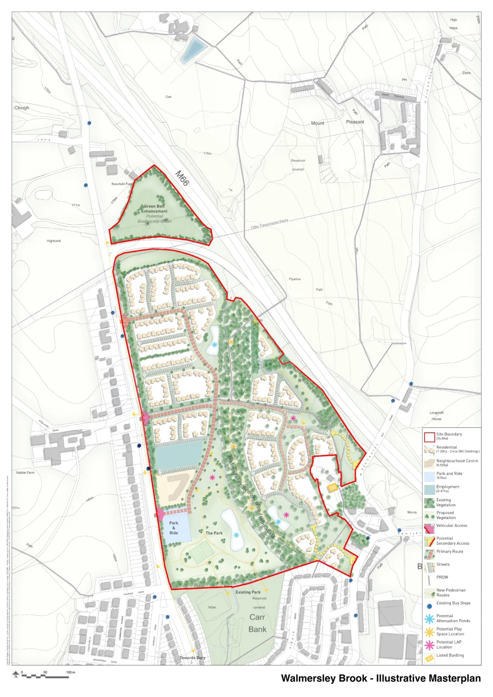
New vehicular access points are proposed from Walmersley Road (A56) and from Walmersley Old Road. These will have the effect of distributing traffic generated by the development and reducing the level of side road turning movements.
Preliminary testing has shown that sufficient capacity will be available using simple priority junctions to access the site.
The access arrangements have been designed at a standard suitable for bus use, with minimum carriageway width of 6.5m in line with Transport for Greater Manchester requirements.
The southern access point has been designed slightly larger than this, with a carriageway width of 7m to allow potential for a range of uses within the Neighbourhood Centre.
Each access point on Walmersley Road has been developed to reflect the existing 40mph speed restriction. However, there is an opportunity to benefit pedestrian/cycle safety and amenity by extending a 30mph restriction along the site frontage.
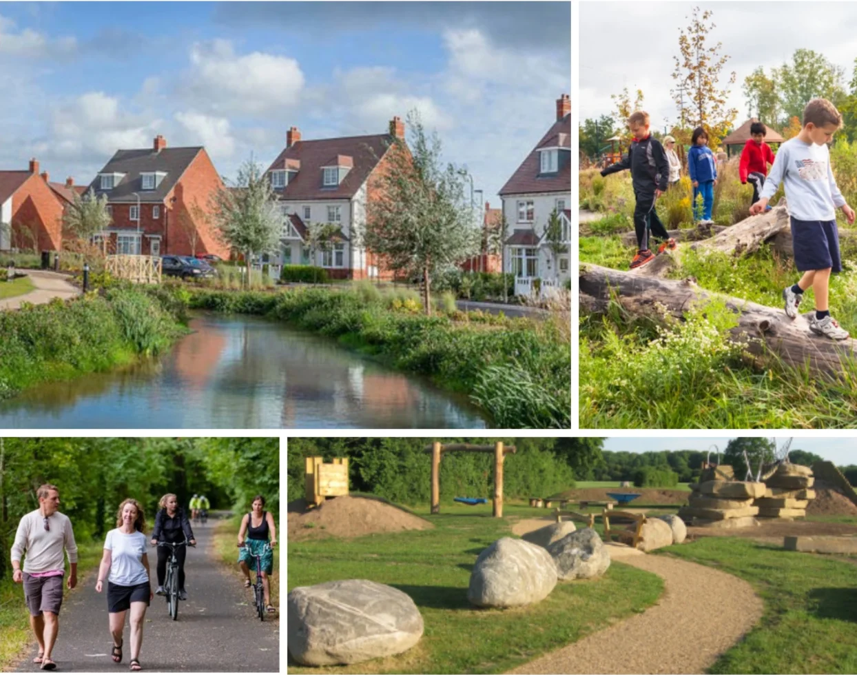
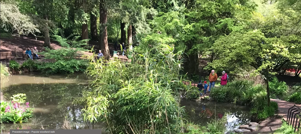
Designed to support a healthy living environment, the development will incorporate footpaths and cycleways that connect with existing Public Rights of Way and link to new and proposed public open space, as well as to the local facilities.
The route of the Village Link will be a particular focus, enhancing its potential for use by the wider community through improved surfacing but also providing off-shoots throughout the development such as along the Walmersley Brook.
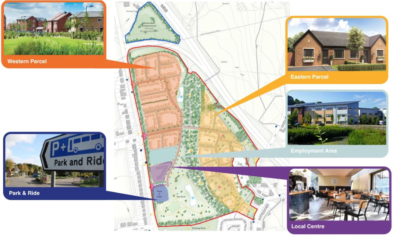
The Masterplan demonstrates how the site can deliver:
The development will be seen as an ‘organic’ extension of the existing settlement and importantly, it will create a transition between the settlement edge and the open countryside beyond the M66.
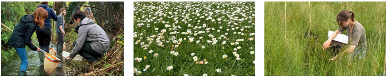
A landscape and green infrastructure framework will incorporate structured tree planting and on-site open space to allow for formal and informal play and pedestrian and cycle connectivity linking with the wider area. The positioning of these spaces will respond to existing natural features within the site such as the Walmersley Brook and the protected trees.
These areas provide opportunity for sustainable drainage and the use of native trees, shrubs and wildflowers will help assimilate the development into the landscape and enhance biodiversity. Existing mature trees and hedgerows will be retained and protected wherever possible.
Up to 350 new homes can be accommodated at Walmersley Brook including up to 140 affordable homes in a range of sizes, densities, types and tenures to appeal to a wide cross-section of homebuyers including first time buyers, families and those looking for energy efficient, low cost homes.
There is potential for housing for older people such as bungalows or apartments for the over 55s located in close proximity to the neighbourhood centre and bus stops to provide easy access to nearby services for older residents. Opportunities also exist for self and custom build plots.
Distinct character areas will correspond in form and scale to the site's surroundings, topography and existing tree cover. Protected trees will be incorporated into the scheme wherever possible.
The Neighbourhood Centre will be designed to serve the existing community as well as the new residents.
It is envisaged that it will incorporate units such as a supermarket, a small parade of shops, a coffee shop and possibly a public house/restaurant/hotel.
The Neighbourhood Centre will incorporate public spaces to encourage social interaction, helping to instill a sense of community.
It would be located along the Walmersley Road frontage and would be easily accessible by walking/cycling for local residents, enhancing the sustainability of this area of Bury.
The Neighbourhood Centre would have the added benefit of creating over 100 full-time equivalent jobs on a site that is well connected to East Bury – one of the Borough’s most deprived neighbourhoods.
The masterplan presents a valuable opportunity to deliver a sustainable, mixed-use community by incorporating an element of commercial/employment development.
Providing space for smaller businesses and local jobs will encourage people to live and work within the area, reducing the need for longer commutes and helping to relieve pressure on local transport networks.
The inclusion of the business/employment area also contributes to the vibrancy of the development, generating activity throughout the day and supporting local shops, services, and amenities. It can help create a sense of place and identity, particularly where workspace is designed to accommodate a mix of small businesses, makers, and creative industries.
The proposed development can help to alleviate existing local highway and parking issues in Bury and nearby Ramsbottom by providing a Park and Ride facility.
Such a facility would encourage the use of public transport for trips into Bury town centre. People travelling to Bury from the north would be able to leave their house by motor vehicle but avoid the congestion in the town centre, taking advantage of the efficient and regular bus service.
The facility would also respond to parking pressures in Ramsbottom by allowing visitors to Ramsbottom to avoid parking in the town, with easy access from the south via the M66. It would be of particular benefit during events, such as the Chocolate Festival, when the town is flooded with visitors.
The site is well located in terms of accessibility to sustainable modes of transport. There are a number of bus stops in both directions located along the length of the western boundary (Walmersley Road) which offer regular services (approximately one service every 10 minutes) to Bury Town Centre, Bury Interchange, Ramsbottom, Rawtenstall, Holcombe Brook and Blackburn.
The bus services integrate with the Metrolink network via the Bury Interchange, the journey to which only takes approximately 15 minutes with services running every 12 minutes. The railway station and tram stop provide services to Manchester city centre.
The A56 offers cycle lanes, which can be followed into the centres of Bury and Ramsbottom.
This consultation sets out how significant benefits can be provided from the residential-led mixed use development of the land east of Walmersley Road, Bury.
Bury Council has previously acknowledged that the site was potentially suitable for development. It is a logical, sustainably located, well contained and partly previously developed Grey Belt site.
The Green Infrastructure Network is a focus of the proposed development, which will create and enhance habitats as well as provide extensive public open space for the community. The woodland belt will be protected and managed to facilitate biodiversity enhancement and leisure routes.
The land east of Walmersley Road is a sustainable, available and deliverable site which would help to address the shortfall in housing within Bury as well as provide other significant benefits.
HSL would welcome support for its proposals and will consider all responses received to this consultation and adapt its plans where at all possible to address any matters raised.
The consultation ended at 5pm on Sunday 14th September 2025. Thank you for those who have provided their comments.